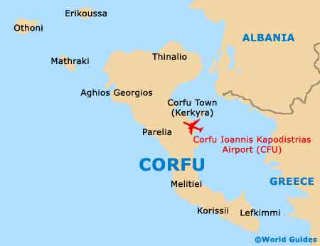
Corfu International Airport Ioannis Kapodistrias (CFU)
Orientation and Maps
(Corfu, Greece)
An extremely popular holiday destination with a coastline exceeding 200 km / 124 miles, the Greek island of Corfu is situated off Albania's shoreline. Corfu is home to countless historical attractions, together with stunning views, more sandy beaches than you could possibly want, and some interesting mountainous scenery. The island of Corfu is shaped rather like a leg and stretches 60 km / 37 miles in length, by 30 km / 19 miles at its widest point, on the northern side.
Standing on the southern side of Corfu Town, the island's Ioannis Kapodistrias (Capodistrias) International Airport (CFU) may be a fairly small complex, but it is always bustling with arriving and departing passengers. The airport is also close to Pontikonisi and serves much of Europe, being especially busy during the summer months.
Corfu International Airport Ioannis Kapodistrias (CFU) Maps: Important City Districts
Mount Pantokrator is the tallest mountain on the island and dominates the north-eastern side of Corfu, measuring around 900 metres / 3,000 feet in height. It is possible to drive to the very top along a winding mountain track, where the views truly take your breath away.
Corfu Town stands on the eastern central coast and is steeped in history, containing many enchanting old buildings and a maze of narrow, cobbled streets. A popular promenade links the citadel area and is lined with a number of superb eateries, many of which specialise in seafood. Those looking to top up their tans on one of Corfu's many sandy beaches should consider the coastal stretches around Agios Georgios, Kassiopi and Palaiokastritsa, amongst other locations.
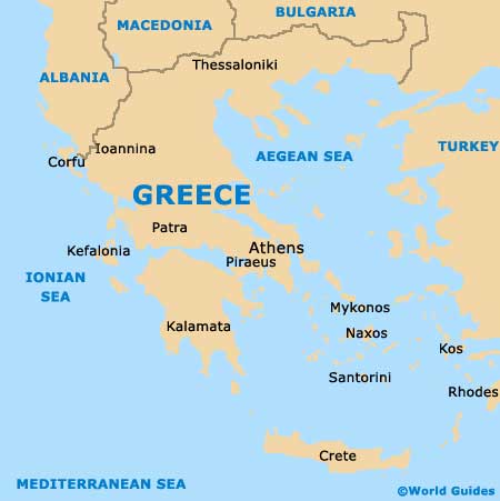
Greece Map
Corfu Map